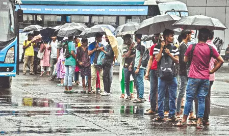
Kolkata, June 10 -- People in South Bengal will get relief from the sweltering heat as a thunderstorm accompanied with mild to moderate rainfall will occur in almost all of the districts in the south between Wednesday and Friday following the formation of two low pressure troughs over Bay of Bengal.
The intensity of rainfall may increase Thursday and Friday. The MeT office said that the districts like North 24-Parganas, South 24-Parganas, East Midnapore, West Midnapore, Jhargram, Howrah will receive moderate rainfall. Kolkata is also expected to receive rainfall.
These districts will experience rainfall accompanied with strong gusts.
The IMD had earlier forecast the potential formation of a low-pressure area in the Bay of Bengal with its movement crucial for the monsoon's progression into South Bengal.
There is some divergence among different weather models regarding the exact timing and trajectory of this low-pressure system. A rough forecast suggests its formation between June 10 and 17, potentially strengthening and moving towards the West Bengal-Odisha coast. Despite North Bengal's early monsoon, the IMD stated that the wind speed and environmental conditions in South Bengal are not yet conducive for its arrival.
Several South Bengal districts had undergone heatwave conditions and discomfort for the past few days and temperature also rose. High water vapour content exacerbated discomfort in coastal and adjacent districts. The intensity and frequency of thunderstorms are expected to increase from Wednesday, though heavy rainfall is not foreseen at this time. North Bengal districts have already welcomed the monsoon ahead of schedule. Scattered rains with thunderstorms are anticipated in the districts, including Darjeeling. However, heavy rainfall is not expected in any North Bengal district in the coming days.
Published by HT Digital Content Services with permission from Millennium Post.