Mumbai, April 8 -- In a significant policy shift aimed at unlocking development potential in Tamil Nadu's hill regions, Housing and Urban Development Minister S Muthusamy announced that the government will redraw boundaries under the Hill Area Conservation Authority (HACA). The move could release up to 60% of the currently restricted areas from the Authority's control, thereby enabling real estate development and infrastructure expansion.
Speaking in the State Assembly, Muthusamy explained that existing HACA boundaries are based on village limits, which vary widely in size-from as little as 2 km to over 10 km. "We have decided to reclassify HACA areas based on survey numbers instead," he said, noting that this method would more accurately reflect the conservation requirements of each specific parcel of land.
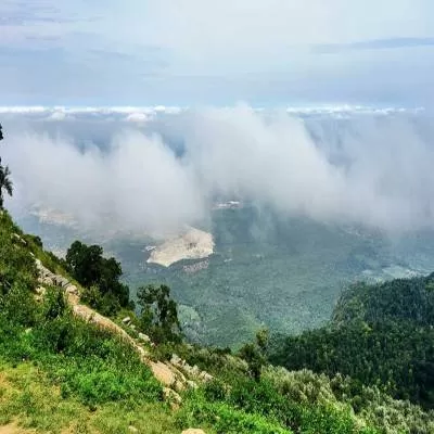
Currently, 597 villages across 16 districts are designated as hill areas under HACA's jurisdiction. The state has already conducted pilot studies in Kanniyakumari and Coimbatore, incorporating advanced tools such as Geographic Information Systems (GIS) to assess Geomorphology, Slope, Lithology, Soil type, and Land Use Land Cover (LULC). The draft report is under review, and once finalised, the approach will be extended to other hill areas.
More Master Plans, More Experts The minister also revealed plans to increase master plan coverage from 7% to 22% of the state's total area. To support this, a dedicated Master Plan Unit will be established within the Town Planning Department, staffed by expert and young town planners.
Additionally, a standard operating procedure (SOP) is in the works for preparing master plans. The SOP will guide authorities on data collection, stakeholder participation, and sustainability standards, ensuring that future urban planning is more structured and responsive.
Development vs Conservation While the proposed boundary reforms are seen as a boon for developers and local economies, they also raise questions about ecological sensitivity in Tamil Nadu's fragile hill ecosystems. However, the department maintains that the GIS-based scientific approach will ensure that only areas suitable for development are released from conservation control.
This shift marks a major milestone in the state's urban development agenda and sets the stage for a new phase of balanced growth across Tamil Nadu's diverse terrain.
Published by HT Digital Content Services with permission from Construction World.