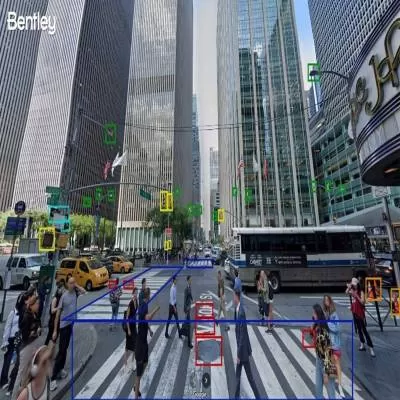
Mumbai, April 10 -- Bentley Systems has announced new asset analytics features powered by Google Maps Platform's Imagery Insights, enhancing its Blyncsy product for faster, AI-driven roadway inspections. Unveiled at Google Cloud Next 2025, the solution leverages Google's Street View, Vertex AI, and crowd-sourced imagery to automate road asset detection and condition monitoring.
The collaboration will help transportation agencies and consultants identify infrastructure concerns early and monitor changes over time, improving maintenance and speeding up post-disaster assessments. Street View's 360-degree imagery offers detailed visual analysis, while Vertex AI helps develop models that predict infrastructure issues before they escalate.
"We have a history of leadership in applying repurposed imagery for roadway maintenance, and the addition of Google's 360-degree imagery and AI will further enhance the value Bentley provides," said Mark Pittman, Director, Transportation AI at Bentley.
Yael Maguire, Vice President at Google Maps Platform & Earth, added, "Bentley combines infrastructure software with our leading AI and mapping tools to deliver powerful insights for mobility planning and maintenance."
Google's Imagery Insights will be generally available in Blyncsy later in 2025.
Published by HT Digital Content Services with permission from Construction World.